Coastal regions of Odisha on alert as cyclone 'Michaung' gains strength
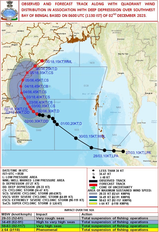
Bhubaneswar, Dec 2: Odisha's coastal areas are on high alert as Cyclone 'Michaung' takes shape in the Southwest Bay of Bengal, posing a threat of heavy rainfall. Currently positioned approximately 500 km east-southeast of Puducherry, 510 km east-southeast of Chennai, 630 km southeast of Nellore, 710 km south-southeast of Bapatla, and 710 km south-southeast of Machilipatnam, the deep depression is anticipated to intensify into a cyclonic storm within the next 24 hours, as per the India Meteorological Department (IMD).
The IMD's forecast suggests that the system is likely to move west-northwestwards, becoming a Cyclonic Storm over the Southwest Bay of Bengal in the next 24 hours. Subsequently, it is expected to shift northwestwards, reaching the west-central Bay of Bengal off the south Andhra Pradesh and adjoining north Tamil Nadu coasts by the forenoon of December 4.
Further progression involves a nearly northward movement, running parallel and in proximity to the south Andhra Pradesh coasts. The cyclone is projected to make landfall between Nellore and Machilipatnam during the forenoon of December 5, with a maximum sustained wind speed of 80-90 kmph, gusting up to 100 kmph.
The IMD's special bulletin warns of resuming rainfall in Odisha on December 3, with an anticipated increase in intensity over the following three days.
Powered by Froala Editor