Cyclonic storm 'Hamoon' intensifies into severe cyclonic storm over Bay of Bengal
Bhubaneswar, Oct 24: The cyclonic storm 'Hamoon,' has strengthened into a severe cyclonic storm in the early hours of Tuesday. According to the India Meteorological Department (IMD), 'Hamoon' has been tracking northeastward at a speed of 18 kmph over the past six hours.
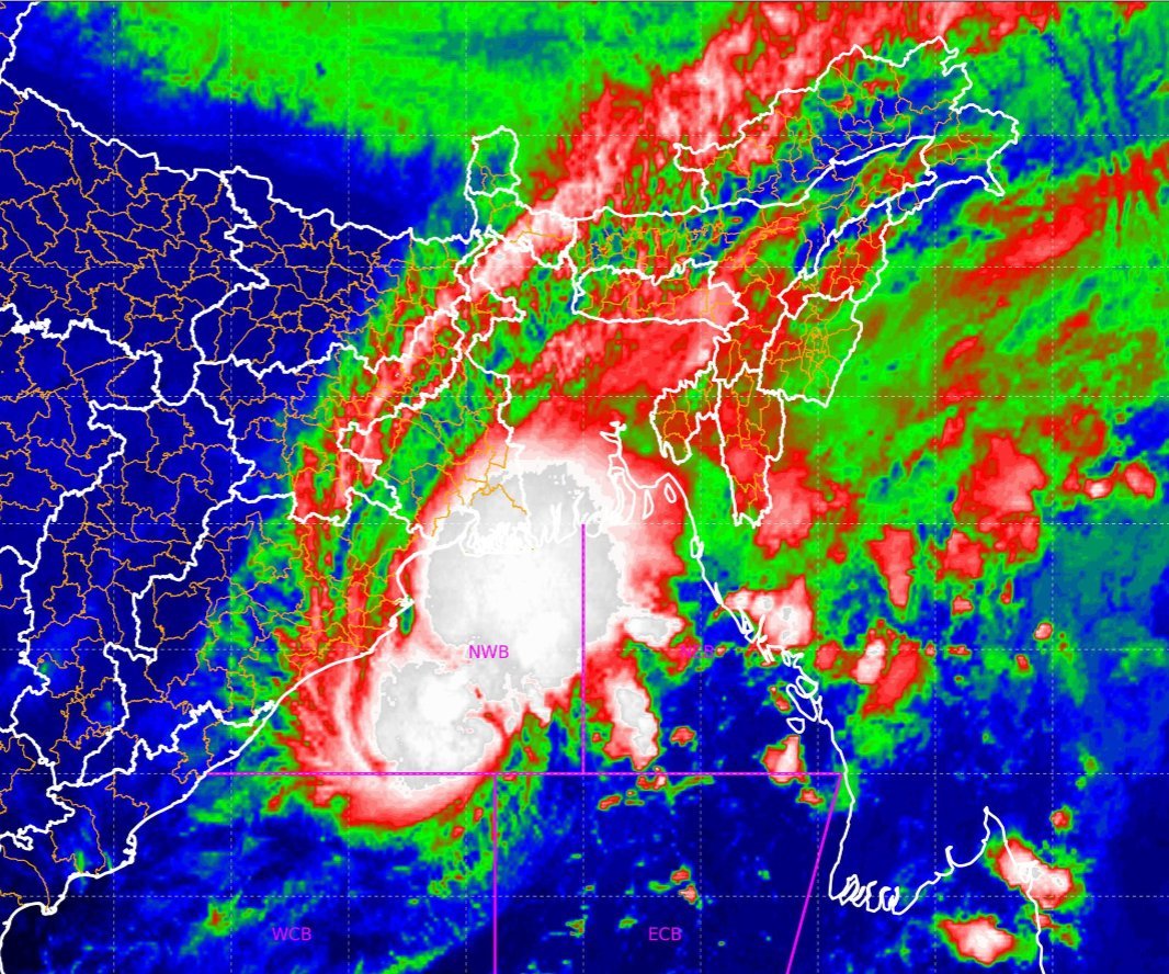
At 2:30 am on October 24, 'Hamoon' was officially classified as a severe cyclonic storm and was positioned over the northwest Bay of Bengal. It was situated approximately 210 km east-southeast of Paradip in Odisha, 270 km south-southeast of Digha in West Bengal, and 350 km south-southwest of Khepupara in Bangladesh, according to IMD reports.
IMD scientist Umashankar Das has informed that 'Hamoon' is expected to intensify further and develop into an extremely severe cyclonic storm within the next six hours. The storm is projected to continue its path, moving almost north-northeastward, and is likely to make landfall on the Bangladesh coast between Khepupara and Chittagong around noon on October 25, assuming the form of a Deep Depression.
In light of the ongoing very rough to high sea conditions, which are expected to persist until October 24 and may become rough to very rough on October 25, fishermen have been strongly advised to refrain from venturing into the sea along the Odisha coast, as well as the Westcentral and North Bay of Bengal until October 25.
Powered by Froala Editor